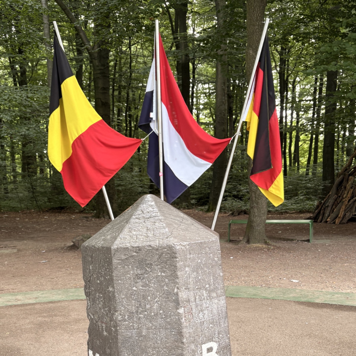
The 3-country point in Europe: Netherlands, Belgium, and Germany
There aren’t many places where you can have breakfast in the Netherlands, pop over to Germany for lunch and finish the afternoon in Belgium. But if you are in this particular part of Europe, you can.
Located the hills just a half-hour away from Aachen, the historical capital of Holy Roman Emperor Charlemagne, this is the Three-Country Point (Drielandenpunt). This unusual spot is where three European countries come together: Germany, Belgium and the Netherlands.
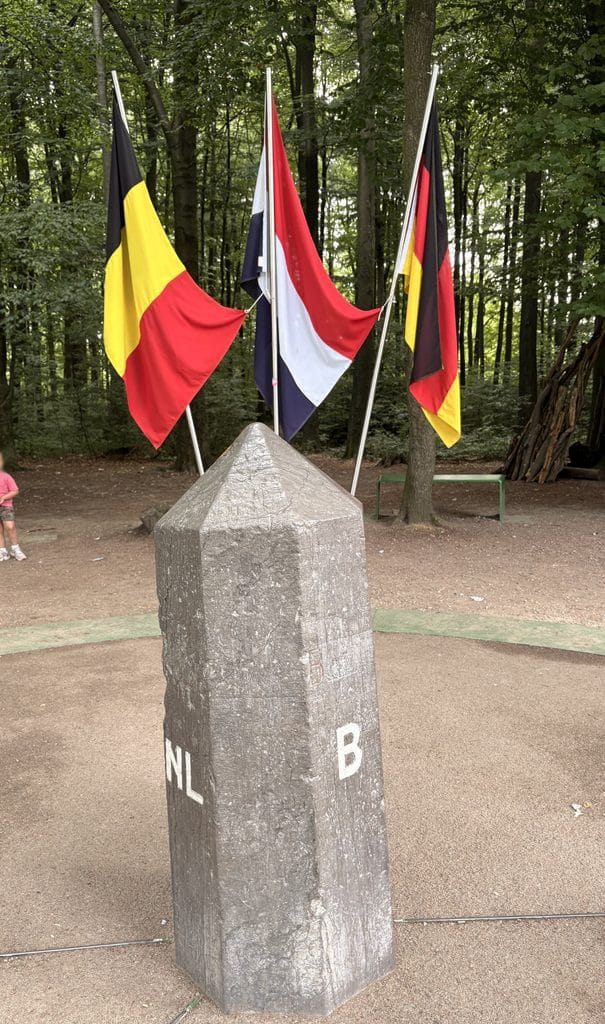
And the best part? There isn’t a border guard, passport control or even a barrier to stop you wandering from one country to another. In fact, you can stand with one foot in Belgium, another in Germany and be rather smug about having visited three countries in the space of a few seconds.
Three countries, one little border marker
The actual meeting point is a rather understated monument considering its historical significance. No dramatic checkpoint and certainly no queue of cars waiting for their passports to be stamped.
Instead, you have a small marker, a few flags and a forested landscape at this European international border. The area is known by different names depending on which side you’re approaching from:
- Drielandenpunt in Dutch
- Dreiländereck in German
- Les Trois Bornes or Trois Frontières in (Belgian) French
History
Over the centuries, this area has been a patchwork of small duchies, principalities and independent territories. The German city of Aachen (known as Aix-la-Chapelle in French) is just a few kilometres away. This was once an important centre of the Frankish Empire under Charlemagne.
Nearby territories belonged to the Duchy of Limburg and other small European states, each with its own ruler, loyalties and borders.
Napoleon’s armies
Things became particularly complicated during the French Revolutionary Wars under Napoleon Bonaparte. In the 1790s, French armies swept through the region, bringing the old feudal territories to an end and incorporating them into France.
The area was reorganised into French departments, and many of the old borders effectively disappeared. For a while, the whole region was part of Napoleon’s expanding empire, rather than the collection of separate states it had once been.
But Napoleon’s defeat in 1815 changed everything again. (The Battle of Waterloo took place about 90 miles away.)
At the Congress of Vienna, the victorious European powers set about redrawing the map of Europe. With the victorious British leading the map-drawing, the territory became part of the United Kingdom of the Netherlands, while the neighbouring lands to the east were awarded to Prussia (now Germany).
Neutral Moresnet zinc mine
The new border was supposed to be straightforward, but one small area caused a rather unexpected headache. Near the village of Moresnet (today Kelmis, in Belgium), there was a valuable zinc deposit known as the Vieille Montagne. Both Prussia and the Netherlands wanted control of it, and neither was particularly keen to let the other have the spoils.
After negotiations failed to settle the matter, the two powers came up with an unusual compromise in 1816: they divided the surrounding territory but left the area containing the mine as a neutral zone, administered jointly by both countries.
And so, Neutral Moresnet was born. Covering just 3.4 square kilometres, it was one of Europe’s smallest and strangest political territories. It had its own administration, local laws and eventually even a flag. The arrangement was initially intended to be temporary, but somehow the little territory survived for more than a century.
From three countries to four
Then came the Belgian Revolution of 1830. Belgium broke away from the Netherlands and became an independent country. This meant that Neutral Moresnet now found itself bordered by three different countries: Belgium, Prussia (later Germany) and the Netherlands.
First World War draws the country borders
Neutral Moresnet’s unusual independence came to an end with the First World War. When Germany invaded Belgium in 1914, it also occupied the tiny neutral territory. Following Germany’s defeat, the Treaty of Versailles in 1919 had Germany relinquishing its claims to Neutral Moresnet and ceding it to Belgium.
And just like that, the four-country point disappeared, leaving the three countries we see today: Belgium, Germany and the Netherlands.
Maastricht treaty
But the real reason there are no border guards is the 1992 Maastricht Treaty. The treaty lay the foundations for the European Union, the euro and freedom of movement between member countries. Fittingly, the Dutch city of Maastricht is a mere 40 minutes by car from the 3-country point.
Labyrinth attraction park and observation towers
If you are looking to spend a few hours in the area, head to the Three-Country Labyrinth, one of the area’s biggest attractions. It is a giant maze with some other interesting attractions that will appeal to families with children.
There are also a couple of observation towers from where you can get a better view. The Belgian Baudouin Tower has a glass lift and a viewing platform about 50 metres high. The Dutch side also has the Wilhelmina Tower, which also offers lovely views across the countryside.
It is also a lovely foresty area all around where you will usually find hikers and walkers enjoying the quiet nature.
Getting there
Address: Viergrenzenweg 97, 6291 BM Vaals, Netherlands.
The Three-Country Point is located at Vaalserberg, near the town of Vaals in the Dutch province of Limburg. It’s only a short distance from Aachen in Germany, making it an easy detour if you’re visiting the city.
The easiest way is by car. There is paid parking near the attraction, but free parking if you park a little further away. The actual 3-Country marker is free to visit and accessible throughout the day.
The labyrinth requires paid admission, with opening hours and prices varying by season.
Read more: