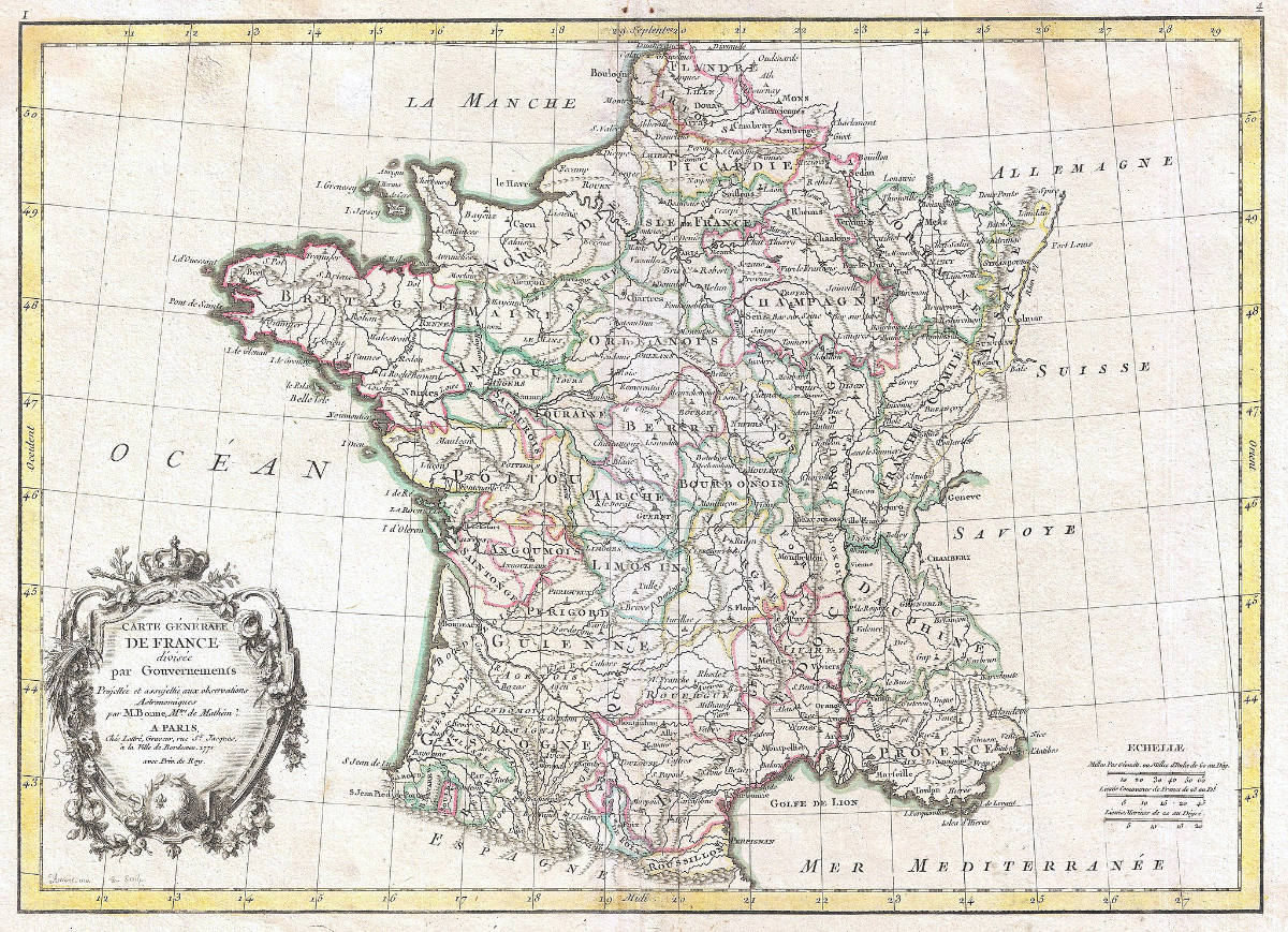
Time to brush up on your French geography! Now, first of all, I should note that France consists of much more than just the land that the Eiffel Tower sits on.
Just as “the sun never sets on the British Empire”, France also had its own colonialist tendencies. At various points in history, the French had conquered lands stretching from Quebec and New Orleans, to Algeria, and to Indochine (Vietnam, Laos, and Cambodia) and more.
Today that “Empire” may be diminished, but there are still many territories outside of what we call Mainland France. But not to worry, I won’t quiz you on them since even born-and-raised Frenchies will struggle to remember it all. Allons-y!
- 1. Paris is the largest city in France.
- 2. There are 12 regions in mainland France.
- 3. The island of Corsica is a territorial collectivity.
- 4. The regions are divided into departments, and departments into communes.
- 5. There are also several Overseas regions, Collectivities and Territories.
- 6. Mainland France has 8 different countries on its borders.
- 7. There are 5 main rivers in France.
- 8. France's largest cities have been built on river banks.
- 9. There are two large mountain ranges.
- 10. From mountains to farmlands, France's topography has it all.
- 11. The country's geography means that it has quite a diversified economy.
- 12. It has quite a varied climate.
- 13. France has 96 departments and 35000 cities and communes.
- 14. The largest French cities are broken down by arrondissement.
- 15. The country has a population of 67 million.
- Quiz
1. Paris is the largest city in France.
Population wise, Paris is the largest city in France, with a population of around 2.1 million. In addition, around 13 million people live in the Greater Parisian area.
Other large cities around France include:
| City | Population (Approx.) |
|---|---|
| Paris | 2.1 million |
| Marseille | 870,000 |
| Lyon | 520,000 |
| Toulouse | 500,000 |
| Nice | 340,000 |
| Nantes | 315,000 |
| Montpellier | 295,000 |
| Strasbourg | 285,000 |
| Bordeaux | 260,000 |
| Lille | 235,000 |
2. There are 12 regions in mainland France.
The territory of France consists of mainland France, as well as several overseas territories. In 1982, there were 22 regions in mainland France. Gradually, these have been amalgamated and combined. Effective 1 January 2016, there are 12 regions that are in the mainland:
- Auvergne Rhône-Alpes
- Bourgogne-Franche-Comté
- Bretagne
- Centre-Val de Loire
- Grand Est
- Hauts-de-France
- Île-de-France
- Normandie
- Nouvelle-Aquitaine
- Occitanie
- Pays de la Loire
- Provence-Alpes-Côte d’Azur
3. The island of Corsica is a territorial collectivity.
There is an additional territory that is an island just off of the mainland: the territorial collectivity of Corsica.
A small island just off of mainland France, Corsica has a language, culture and flag of its own. It had been ceded to French King Louis XV by the Republic of Genoa (now part of Italy) to pay off some debts in the year just before Napoleon Bonaparte was born, in 1768.
4. The regions are divided into departments, and departments into communes.
These regions are subdivided into 96 departments, which are further divided into 332 arrondissements or over 35,000 communes.
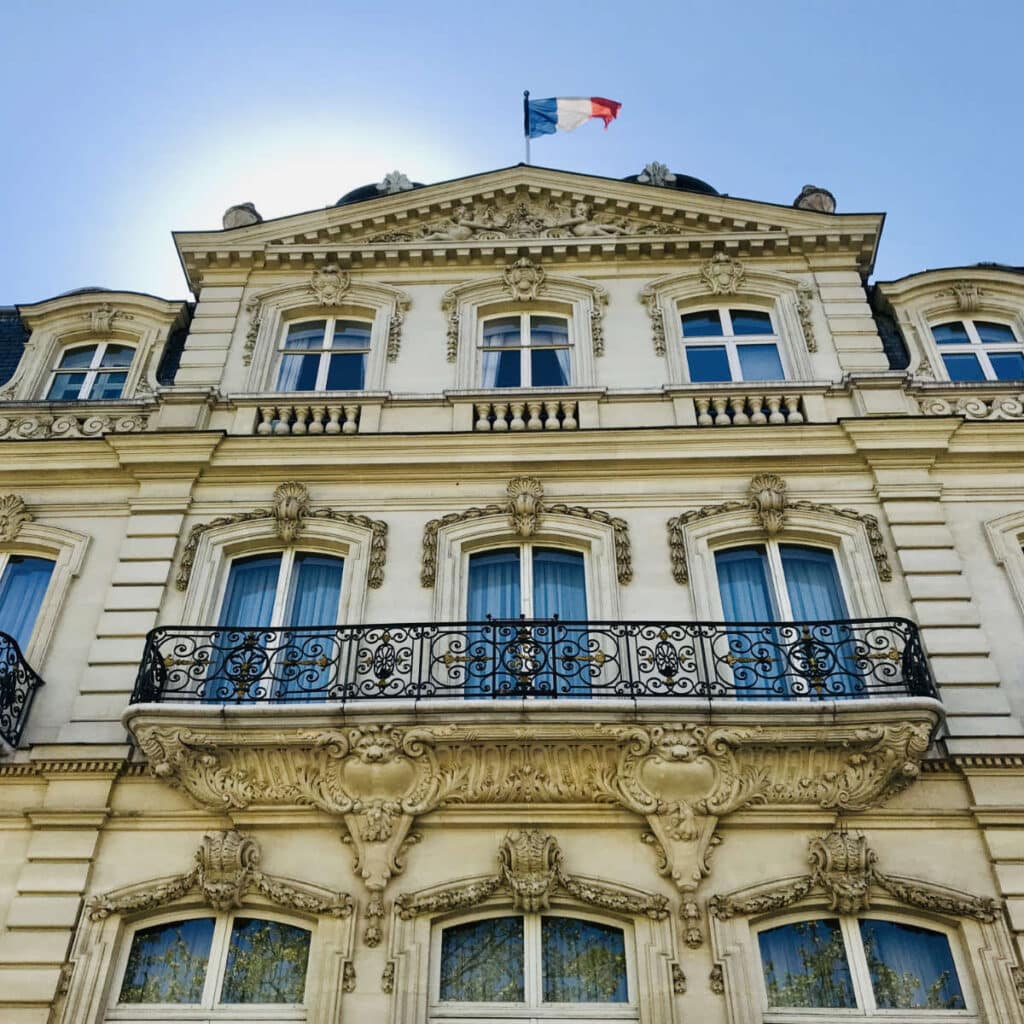
Some communes have as few as 20 people, although in recent years there has been a push to combine several communes together.
5. There are also several Overseas regions, Collectivities and Territories.
As I mentioned before, French history involved explorers and sailors like Jacques Cartier setting off from Saint Malo to explore the world. Behind him went the soldiers, ready to conquer vast territories from Quebec in Canada to Haiti in the Caribbean, and Algeria in Africa.
Much like the English Empire, the French Empire has also shrunk today, compared to what it was in the past. There are nevertheless quite a few overseas islands and territories that are still considered part of France.
- Five overseas regions (régions d’outre-mer):
- Guadeloupe
- French Guiana
- Martinique
- Mayotte
- Réunion
- Four overseas collectivities (collectivités d’outre-mer):
- Saint-Pierre and Miquelon
- Saint Barthélemy
- Saint Martin,
- Wallis and Futuna.
- One overseas “country” (pays d’outre-mer): French Polynesia.
- One sui generis collectivity (collectivité sui generis): New Caledonia
- One overseas territory (territoire d’outre-mer, or TOM): French Southern and Antarctic Lands divided into 5 districts:
- Kerguelen Islands
- Crozet Islands
- Île Amsterdam & Île Saint-Paul
- Adélie Land
- Scattered islands
- One uninhabited island in the Pacific Ocean off the coast of Mexico: Clipperton.
6. Mainland France has 8 different countries on its borders.
Mainland France sits on the Atlantic Ocean and English channel on one side, with land borders with several European countries.
On the North, there are:
- Belgium 385 miles (620 km)
- Luxembourg 45miles (73 km)
On the East:
- Switzerland 356 miles (573 km)
- Germany 280 miles (451 km)
On the South:
- Spain 387 miles (623 km)
- Italy 303 miles (488 km)
- Andorra 35 miles (56 km)
- Monaco 2.5 miles(4 km)
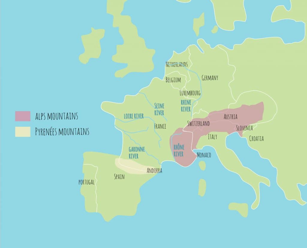
7. There are 5 main rivers in France.
There ar 5 main rivers stretching across mainland France:
- the Seine (which flows starts in Dijon and flows to Le Havre in Normandy)
- the Rhône (South of France near Marseille, Provence)
- the Loire (through the Loire Valley)
- the Garonne (near the Pyrenees mountains and Spain)
- the Rhine (in Alsace and Germany)
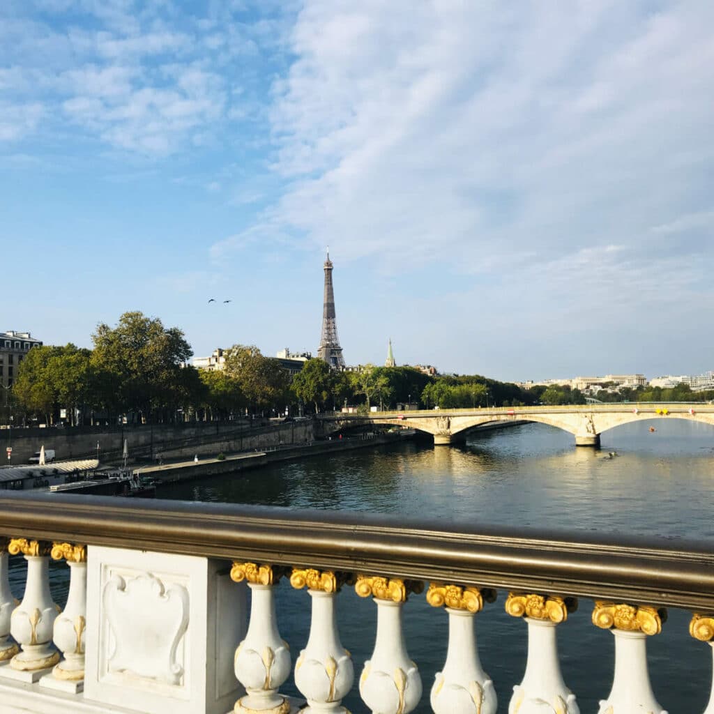
8. France’s largest cities have been built on river banks.
But there are many smaller rivers as well. The biggest cities in France are located at the confluence of these smaller rivers coming from a different direction and merging into the bigger ones:
- Paris – at the junction of the Seine and Marne rivers
- Lyon – at the junction of Rhône and Saône rivers.
- Bordeaux – at the junction of the Garonne and Dordogne rivers.
- Tours – at the junction of Loire and Cher rivers.
- Nantes – at the junction of Loire and Sèvre rivers.
- Orléans – at the junction of Loire and Loiret rivers.
☞ READ MORE: Best cities to live in France
9. There are two large mountain ranges.
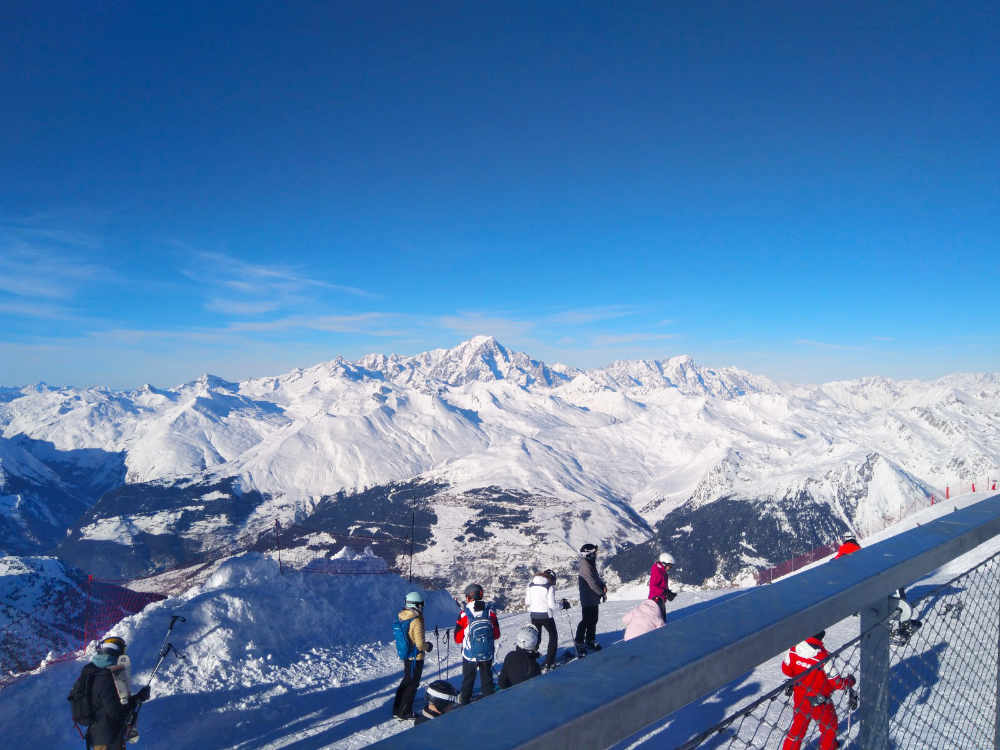
France has two large mountain ranges on its territory, the Pyrenées in the South, on the border with Spain, and the Alps on the eastern border with Switzerland.
It is home to Mont Blanc, the 2nd highest mountain in Europe , after Mount Elbrus in Russia. It rises to over 4808m above sea level.
The mountain ranges are believed to have been created during collision between the continental tectonic plates of Africa and Europe over 65 million years ago.
10. From mountains to farmlands, France’s topography has it all.
The topography of France is divided into several grand areas, each with its own distinct geography.
- The northern part of the country is mostly flat, with low-lying land and a few hills.
- The central region is characterized by rolling hills and small mountains, including the Massif Central and the Ardennes. This area is often called le vide in French, meaning “the empty land”.
- The southern region is marked by the Pyrenees and the Alps mountains, which form the border with Spain and Italy.
- The Mediterranean coast is known for its long beach towns and rocky cliffs like the Calanques. It also has many perched hilltop villages in the area.
11. The country’s geography means that it has quite a diversified economy.
France has a developed and diversified economy, with a strong focus on services and manufacturing. The country is a major producer of agricultural products, including wine, cheese, and other delicacies.
It is also a major producer of machinery, chemicals, and automobiles. Large French companies include Airbus, Michelin, and Total.
France is also one of the top tourist destinations in the world, with millions of visitors each year. The country has also a major financial center called La Defense, with a large stock exchange and many international banks based in Paris.

12. It has quite a varied climate.
France has a diverse climate, with different regions experiencing different weather patterns.
- The northern part of the country has a maritime climate, with snowy winters and cool summers.
- The central region has a continental climate, with rainy winters and hotter summers. Paris in particular is known for the amount of rain and cloudy weather patterns.
- The southern region has a Mediterranean climate along the French Riviera, with mild winters and hot summers. It is also known for a weather pattern of winds called the Mistral.
- The mountain regions have alpine climates, with cold snowy winters and cool summers.
13. France has 96 departments and 35000 cities and communes.
The regions in mainland France are subdivided into 96 departments. The departments are further divided into over 35,000 communes (meaning towns).
Some towns have as little as 20 people in them, but still have their own communal government and mayor. As a comparison, France has 40% of all the communes in Europe. Neighboring Germany which is similar in size and population, has only around 11,000 communes, while Italy and Spain have around 8000 communes.
There has been some debate about reducing the number of communes, but the mille feuille continues!
14. The largest French cities are broken down by arrondissement.
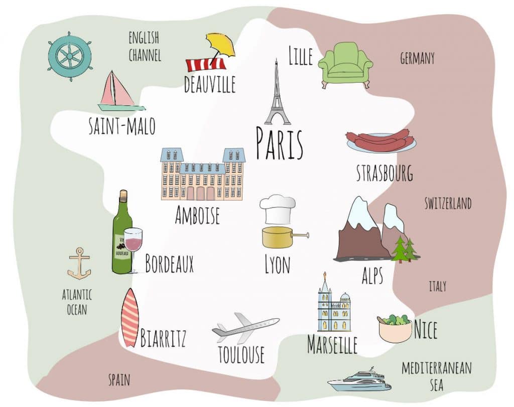
There are several large cities in France, the biggest among them all being Paris, which is also the capital. Marseille is considered the 2nd city, and the oldest.
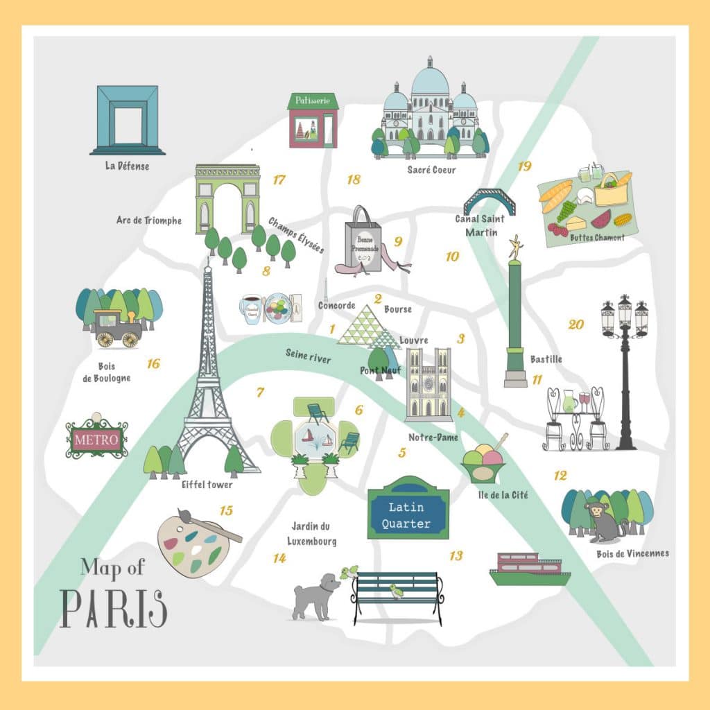
Some of the larger cities like Paris, Marseille and Lyon are further divided into 332 arrondissements, each of which also has its own layer of government. For instance, Paris is divided into 20 arrondissements, and each arrondissement has its own town hall and mayor.
15. The country has a population of 67 million.
As of 2021, France has a population of around 67 million, with around 80% of the population living in large urban centers. The largest is the Greater Paris area, which includes 2 million in the city of Paris, and 10 million in the surrounding Petit and Grand couronne area.
Other large beautiful cities with significant populations include Lyon, Marseille, Nice, and Toulouse. The population is diverse, with significant immigrant communities from North and West Africa, as well as Asia and Eastern Europe.
The official language is French, but there are also regional languages spoken, such as Breton, Occitan, and Basque.
Quiz
So with all that being said, let’s get to the fun stuff. Can you identify these famous attractions and monuments in France?
1. What are the Calanques?
- a) A series of cliffs near Marseille.
- b) A main dish featuring boiled salmon and broccoli.
- c) A type of farmers’ market in Normandy.
- d) A series of Châteaux in the Loire Valley.
2. Which city in France is the furtherest South?
- a) Annecy
- b) Lille
- c) Montpellier
- d) Nantes
3. In the 13th century, Catholic Popes lived in France. Where did they live?
- a) Avignon
- b) Aix-en-Provence
- c) Arles
- d) Montpellier
4. What is the nickname of inland France?
- a) Pentagon
- b) Hexagon
- c) Octagon
- d) Decagon
5. Which French city has a very famous annual brocante (flea market)?
- a) Tours
- b) Toulouse
- c) Rennes
- d) Lille
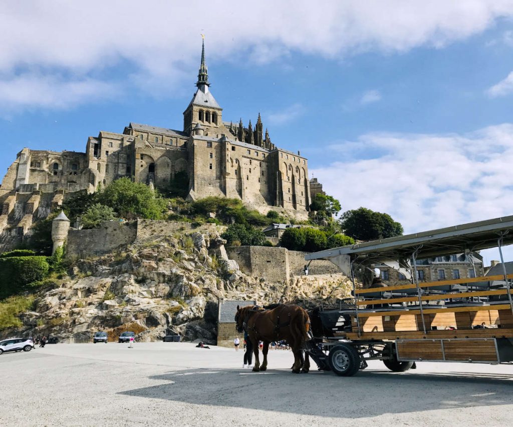
6. Where is Mont Saint Michel located?
7. Which one of these is not a river in France?
- a) Seine
- b) Rhône
- c) Rhine
- d) Danube
8. Which country does France not have a border with?
- a) Spain
- b) Italy
- c) Germany
- d) Netherlands

9. Which one of these French regions does not produce wine?
- a) Alsace
- b) Bourgogne
- c) Bretagne
- d) Savoie
10. The border city of Metz is near which country?
- a) Switzerland
- b) Germany
- c) Luxembourg
- d) Belgium

For more fun, don’t forget to check out our other quizzes. A bientôt!
¹ Featured Image: Lattre, Jean, Atlas Moderne ou Collection de Cartes sur Toutes les Parties du Globe Terrestre, c. 1775. courtesy of Wikipedia Commons
